Using MT Technologies For Rapid, Cost Effective and Accurate Detection Of Aquifers

Many populated areas such as the southwest USA, Libya, and South Asia draw some of their water supply from deep aquifers. MT/AMT has considerable potential to map the lateral and vertical extent of the aquifers
Solve Common Problems in Groundwater Exploration
The US Geological Survey (USGS) used MT/AMT in 2003 to map the structural controls on groundwater flow in the Culpeper Basin (next to the Washington, DC, metropolitan area). The presence or absence of ground water in this area has a direct effect on real estate values: at least one major corporation selected the location for its large computer server operations on the basis of groundwater available for cooling. The USGS also used AMT to map a Karstified zone in Texas.
The Institute of Geophysics in Hanoi, Viet Nam, used a combination of AMT and DC Resistivity (VES) in the early 1990s to map both shallow and deep aquifers. In 2002 China's Bureau of Geophysical Prospecting (BGP) used AMT to map water-saturated faults hidden beneath overburden in East China. The warm water from the faults was used for space heating.
Deep Rapid Reconnaissance and Detailed Follow-Up
From near-surface down to any practical drilling depth and beyond, MT allows rapid reconnaissance of areas as large as tens of square kilometers, while detecting conductive zones to 2000 m and deeper.
Closely spaced stations along lines or nets provide data redundancy, high lateral resolution, and a continuous picture of the subsurface resistivity structure.
In a two-pass methodology, station and line spacing are as wide as possible in the first pass to keep cost to a minimum. Once areas of interest have been identified, a second pass with more stations at closer spacing increases resolution. The result is rapid, accurate, and cost-effective identification of conductive mineralized zones.
Rapid, Cost-Effective Mapping Of Conductive Zones
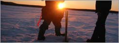
Equipment weighs only 30 kg per site, so it's portable by backpack, ATV, snowmobile, or helicopter, from tundra to jungle, in any season. This logistic simplicity reduces cost and increases productivity.
The small footprint and environmentally benign installation make the technique practical almost anywhere.
Flexible site location and offline sensitivity allow meaningful profiles to be constructed without the rigid grid of methods like seismic and IP.
Induction vectors indicate the direction and relative strength of offline conductors and are especially useful where the surface is resistive or frozen (no electrodes required).
MT/AMT sees through the thick conductive clay (impenetrable by airborne or other surface techniques) that covers many prospective areas.